(By Takis Galanopoulos)
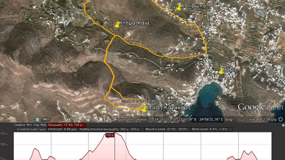
The file below, after downloading, requires Google Earth application to view:
STASH_KANAKARH_XROUSSA_BARH
Total path length : 6.890 m.
Altitude at start : 30 m. – Maximum altitude : 122 m.
Total altitude difference : 242 m.
Maximum slope : 22%, average slope : 7 %
For viewing you have to use the Google Earth ... Read More
 English
 Ελληνικα


